B.Sc. Geography
Program Profile
The department was established in 2017
Study length: 4 years (eight semesters), leading to a Bachelor’s Degree in Education — Geography
The programme combines geographical sciences (physical & human geography + modern geographic technologies) with pedagogical / educational training, to prepare graduates to become geography teachers — especially at intermediate and secondary school levels The curriculum of the Geography Department includes two main parts:
Geographic / Scientific Subjects
Physical geography: climate/climatology, geomorphology, hydrogeography (rivers, groundwater, lakes), environmental geography, natural resources, human–environment interactions, etc
- Human / socio-economic / regional geography: population geography (distribution, density, migration), economic geography (resources, agriculture, industry, trade), urban and industrial geography, geopolitics, urban & rural settlement patterns, spatial distribution of services and infrastructure, regional planning, etc
- Technical / applied geography: use of modern tools and techniques: GIS (Geographic Information Systems), remote sensing, map reading/drawing, spatial data analysis — preparing students to analyse geographic phenomena using modern methods.
Educational / Pedagogical & Teacher-Training Subjects (because the department belongs to the College of Basic Education)
- Foundations of Education; Educational Psychology; Methods of teaching geography; Classroom management; Educational measurement & evaluation; pedagogical theory and practice
- Practical training: real teaching practice in schools (practical/pedagogical application) under academic supervision.
Occupational profiles of graduates
Geography Teachers / Educators Level: Intermediate and secondary schools. Role: Plan and deliver geography lessons, develop teaching materials, assess student learning, and manage classrooms. Skills Applied: Pedagogical methods, curriculum knowledge, classroom management, lesson planning. Employers: Public schools, private schools, educational centers.
- Urban and Regional Planners Role: Assist in planning and managing urban, rural, and regional development projects. Tasks: Mapping land use, analyzing population distribution, evaluating environmental impact, and recommending sustainable development strategies. Skills Applied: GIS, cartography, data analysis, spatial planning. Employers: Government planning departments, municipalities, urban development authorities.
- Environmental and Resource Management Specialists Role: Manage, conserve, and plan for natural resources and environmental sustainability. Tasks: Conduct environmental assessments, monitor resource use, advise on climate and water management issues. Skills Applied: Physical geography knowledge, environmental analysis, GIS, research methods. Employers: Ministries of Environment, Water Resources, NGOs, environmental consultancies.
- Geospatial / GIS Analysts Role: Collect, process, and analyze spatial data for decision-making. Tasks: Produce maps, spatial models, and reports for urban planning, disaster management, or resource allocation. Skills Applied: GIS software, remote sensing, spatial data analysis, cartography. Employers: Government agencies, private companies, NGOs, research centers.
5. Researchers and Academic Professionals Role: Conduct studies and applied research in geography and education. Tasks: Fieldwork, data analysis, publishing reports or academic papers, presenting findings at conferences. Skills Applied: Research design, data collection, statistical analysis, report writing. Employers: Universities, research institutions, think tanks, NGOs.
Qualification awarded
Bachelor degree of geography in education college
Length of programme
4 years (8 semesters)
Number of credits
240 ECTS credits
Mode of Study
Full time on campus
Read more about the programme
Get detailed information about the programme requirements, courses, credits, and educational objectives as a PDF file.
Program Educational Objectives (PEOs)
The Program Educational Objectives (POEs) of the Geography department (Geo dept) are to prepare graduates who will:
1. Prepare Competent Geography Educators
o Equip graduates with the knowledge, skills, and pedagogical competence required to teach geography effectively at intermediate and secondary school levels.
o Develop teaching methods, classroom management, and evaluation skills suitable for modern educational contexts.
2. Develop Scientific and Analytical Skills
o Enable graduates to analyze, interpret, and understand natural and human geographic phenomena.
o Foster critical thinking and problem-solving skills to examine spatial patterns, environmental issues, and human–environment interactions.
3. Promote Use of Modern Geographic Technologies
o Train students in Geographic Information Systems (GIS), remote sensing, cartography, and spatial data analysis.
o Apply technological tools to study, model, and solve geographic problems.
4. Encourage Research and Field-Based Learning
o Cultivate the ability to conduct geographic research, field studies, and surveys to collect, analyze, and report geographic data.
o Encourage applied learning experiences connecting theoretical knowledge with practical applications in local and regional contexts.
5. Foster Awareness of Societal and Environmental Issues
o Prepare graduates to address contemporary challenges such as environmental sustainability, urbanization, climate change, and regional planning.
o Promote responsible citizenship and contributions to community development through geographic knowledge.
Program Learning Outcomes
After successfully completing this programme, students should have: Graduates will be able to:
1. Demonstrate comprehensive knowledge of physical geography (climate, geomorphology, hydrology, natural resources).
2. Demonstrate understanding of human and socio-economic geography (population, settlement patterns, urban and rural development, economic geography).
3. Apply geographical concepts, theories, and principles to analyze natural and human phenomena.
4. Demonstrate knowledge of environmental and regional planning issues relevant to Kurdistan and Iraq.
Cognitive and Intellectual Skills Graduates will be able to:
5. Analyze and interpret spatial patterns and geographic data using scientific and quantitative methods.
6. Apply critical thinking to solve geographic problems and evaluate human–environment interactions.
7. Conduct research and field studies, including data collection, analysis, and interpretation.
8. Integrate knowledge from various geographic subfields to make informed decisions and recommendations for community and regional development.
Practical and Technical Skills Graduates will be able to:
9. Use modern geographic technologies, including GIS, remote sensing, and cartography tools, to analyze and present spatial data.
10. Prepare maps, charts, and other visual representations of geographic information.
11. Plan and execute fieldwork and practical projects in both physical and human geography.
12. Apply geographic knowledge and tools in problem-solving related to environment, urban planning, and resource management.
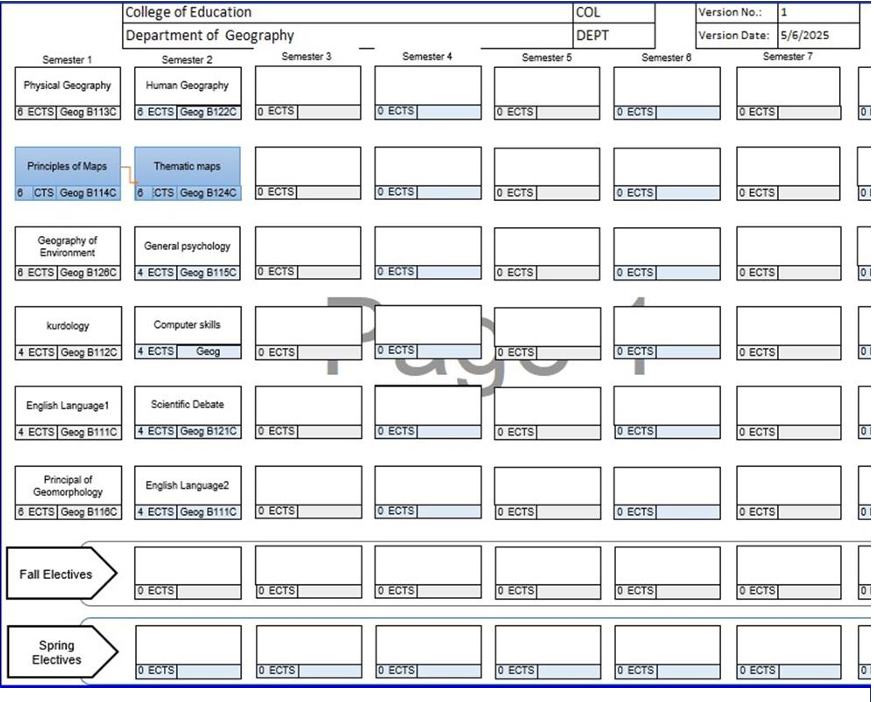
Programme structure diagram with credits
Yearly Timeline
Sept. 1, 2026
⚠️ First year students start around mid-October
⚠️ First year students start exams around 20 of January
July 1, 2027
Check out the full academic calendar on UoD's webstie.
Programme Coordinator
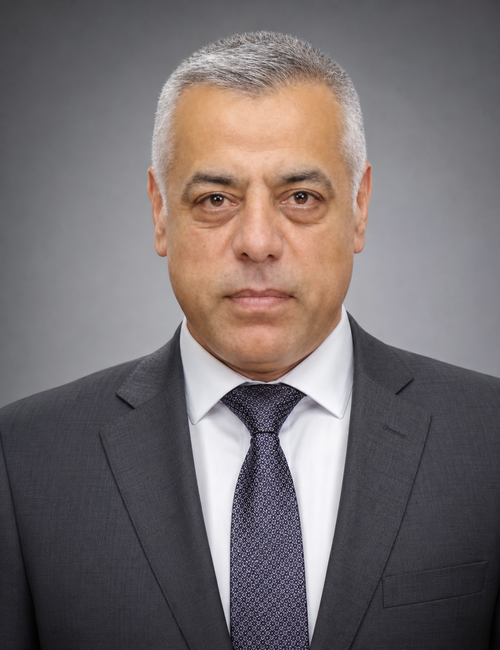
Professor in Urban Geography
Geography
College of Education
University of Duhok
Apply to the Programme
Public undergraduate admissions in the KRG region are managed centrally by the Ministry of Higher Education through the online ZankoLine portal (regayzanko.com). After Grade 12 Baccalaureate results are released, high schools provide students with unique login credentials to rank their preferred universities and B.Sc. majors during a 10–14 day registration window. Final placement is automatically determined by the student's Grade 12 average, subject choices, and department capacity.